


Tracking the critically endangered Pink Iguanas of the Galápagos
December 30, 2019
Last year, around Christmas time, my colleagues and I are were in the process of assessing the performance of a new, custom-developed GPS device designed to track the elusive and critically endangered Galápagos Pink Land Iguana (click here for Part One). Among the various objectives of this project is gaining a better understanding of the species’ ecology and habitat use, information crucial to developing an appropriate conservation strategy.
Since our trip in late 2018, we spent most of 2019 organizing the complicated logistics for the expedition needed to start tracking these animals in their environment.
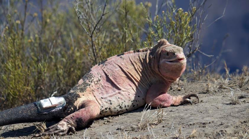
Pink Iguanas (Conolophus marthae) are only found on Wolf Volcano (WV), the highest volcano in Galápagos, located on the north end of Isabela Island. Just getting to the base of WV is challenging, and once there you are still left with the hurdle of ascending to the top, 1700 meters (over 1 mile) up. In fact, pink iguanas cluster on WV’s peak, especially during what we believe is their reproductive season.
No trail is available, meaning that the 14 km hike to the top has to be “opened” as we proceed. It is easy to imagine how difficult it would be to carry all the research equipment (satellite antenna, GPS devices, gateway infrastructure, power generator, etc.) along with water, food, and personal supplies to the top of WV.
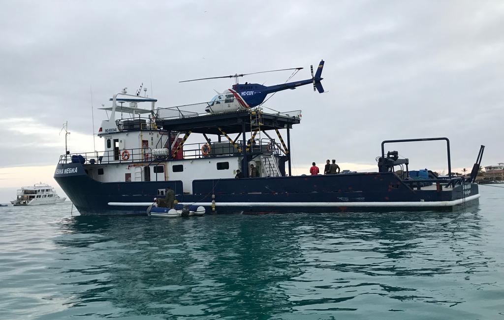
That is why, after much coordinating and organizing, our long-time project partners at the Galápagos National Park Directorate (GNPD) agreed to let us use the helicopter, only available to them for a very limited time, to transport ourselves and all our gear to the top of WV.
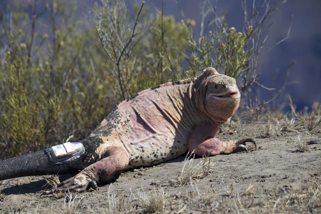
During 8 days of field work in September we were able to install and activate the satellite gateway station and attach GPS tags to 20 iguanas, 15 Pink Iguanas and 5 Yellow Iguanas (Conolophus subcristatus), a more common and widely distributed species of Galápagos Land Iguanas.
On WV, Pink and Yellow Iguanas are syntopic, meaning they live together in the same habitat. By having GPS tags on both species we will be able to examine differences in their habitat use.
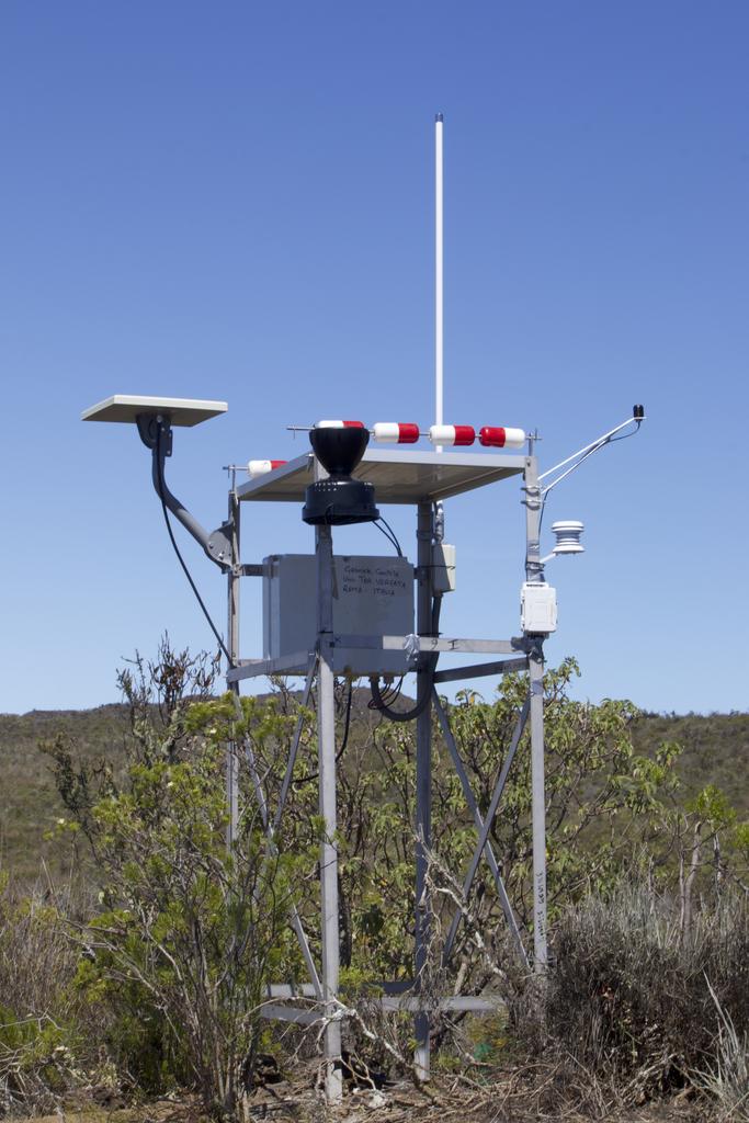
The GPS tags were attached to iguanas using a combination of epoxy-glue and surgical epidermal-stitches, to ensure they will stay attached to the iguanas for the longest possible time-span. We also installed 5 weather stations that will help us construct habitat models for the two species.
While in the field, impatient to know whether the data transferring protocol was in fact working, we used a portable satellite phone to contact our engineer colleagues at the University of Rome Tor Vergata, who confirmed that the satellite gateway was performing properly, and that many of the GPS tags attached to the iguanas were already transmitting data to our computer server in Rome.
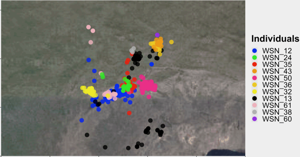
Since returning from Galápagos in October, we have been accumulating invaluable information from the GPS tags attached to the iguanas.
For example, while reconstructing the movements of different individuals we discovered that Pink Iguanas move inside the volcano’s caldera, something we knew for Yellow Iguanas but not for Pinks.
We are also in the process of reconstructing some of the environmental characteristics that are unique to Pink Iguanas, compared to Yellow Iguanas. For example, we are analyzing the temperature range profiles of the different individuals to characterize species differences.